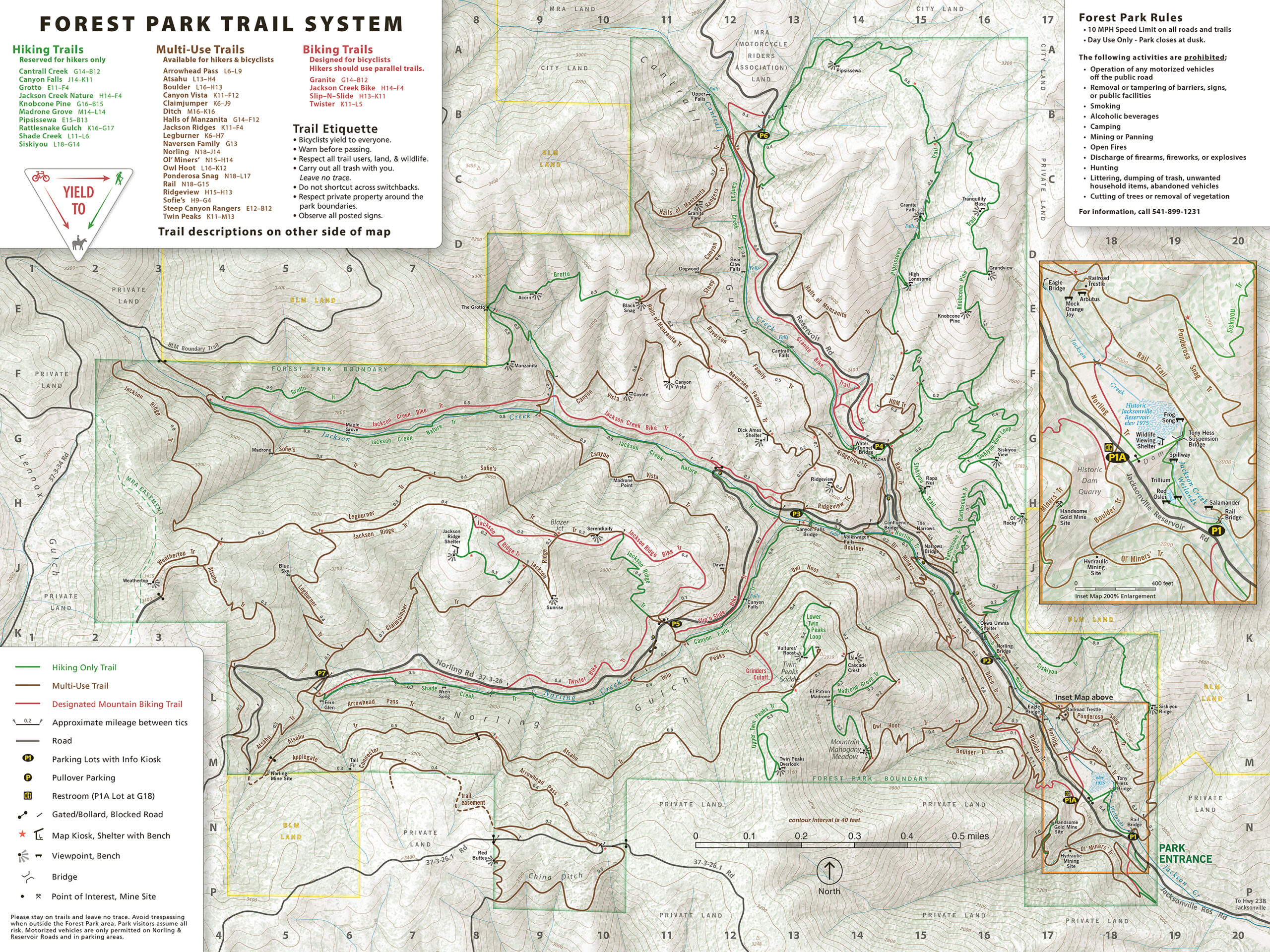
Forest Park
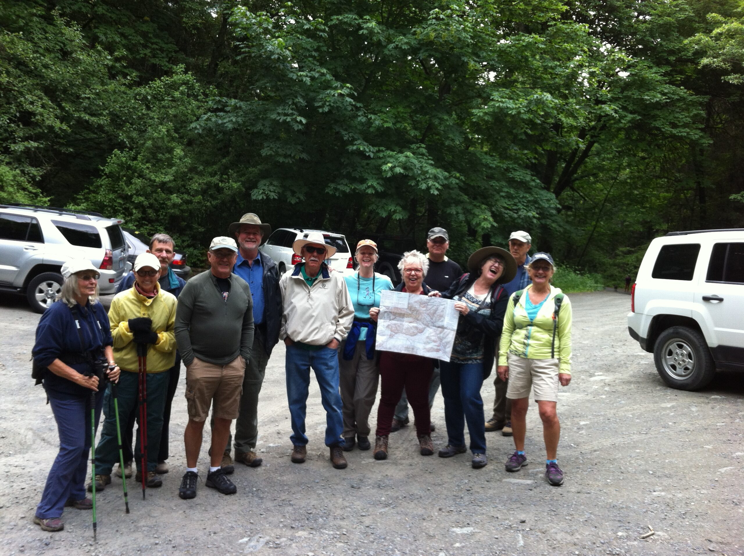
Jacksonville’s Forest Park is a multi-use recreational park with forty-two miles of trails jointly supported and managed by the Jacksonville Woodlands Association, the City of Jacksonville, and Forest Park volunteers as a city park. The nearly 1,500 acre park is located on Reservoir Rd. in the Jackson Creek watershed just one mile
from the city limits.
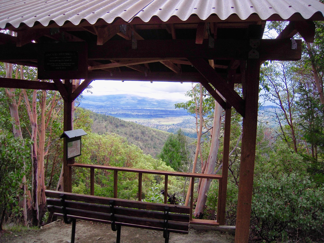
Beginning at an elevation of 1,920 feet at the park entrance and rising to 3,455 feet at the Weathertop bench on Jackson Ridge, visitors can enjoy views of the Cascade and Siskiyou mountains as far north as Three Sisters and as far south as Red Buttes in California from the higher elevations viewpoints. Near the park entrance is the three acre Wetlands Nature area which includes a wildlife viewing shelter overlooking the former Jacksonville Reservoir, some fairly flat trails, and an outdoor classroom.
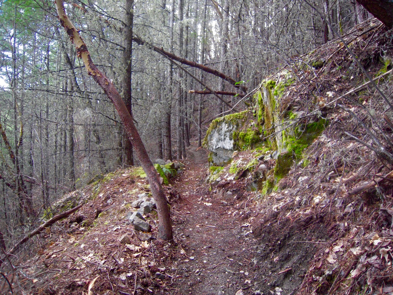
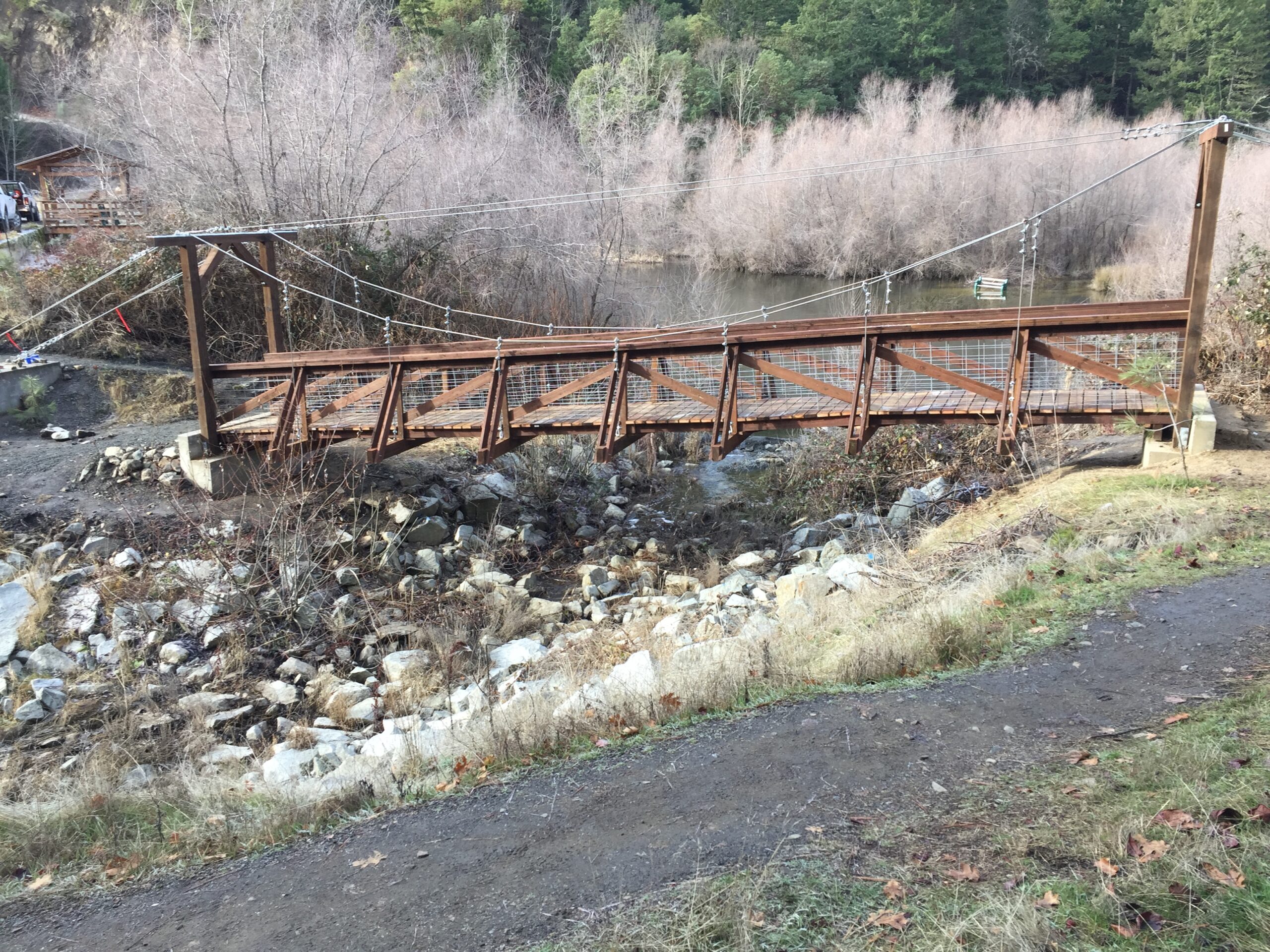
Within the park, Jackson Creek and its two stream tributaries, Norling Creek and Cantrall Creek, provide seasonal streamflow and a healthy riparian corridor for aquatic species along narrow hiking trails. Forest Park’s upland areas boast a variety of plant and animal species indicative of the Klamath Mountains Ecoregion. At least seven species of snake, three of both lizards and salamanders, many residential and migratory birds, and a variety of mammals from tiny shrews to black bear and cougar, make the park a wonderful opportunity for nature study. Madrone groves, manzanita thickets, oak savanna, and shaded softwood forests intermix throughout the park, making any outing an experience in nature’s diversity.
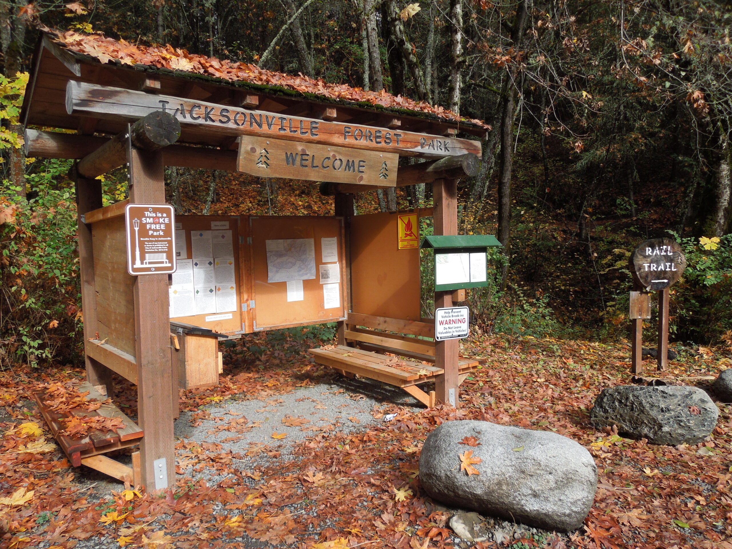
While a majority of the terrain is cloaked in vegetation, various rock outcroppings and soil types speak to the long and varied geological history. The granitic plutons that brought white settlers in search of gold dominate the central portions of the park, with the metamorphosed sediments of an ancient seafloor acting as bookends. Evidence of mining activity is a frequent feature and informational kiosks are located throughout the park.
A large part of park and trail maintenance is carried out by volunteers who are trained to International Mountain Bike Association (IMBA) standards on over thirty-eight miles of multi-use and hiking trails. Another four miles of mountain biking only trails are maintained by recreational bikers. IMBA standards are recognized by the Oregon Parks Department of Recreation and international agencies as standards for sustainable trails. In this park, with its steep terrain and multiple soil types, careful attention is made in the design of the trails for a maximum 12-15 percent grade with frequent grade reversals to control erosion.
Eleven stream crossing bridges, seven shelters, fifty-five benches, information kiosks, a modern pit toilet, and eight easily accessible parking areas are enhancements to the trail system. Printed maps are available at parking area kiosks P-1, P-1A, and P-2 to guide visitors. Instructions to download the trails map from Avenza Maps to smart phones are located beside the printed maps boxes. Over fifty “You Are Here” map kiosks are located throughout the park to assist park visitors in verifying their location while on the trails. Wooden signs at trail heads and intersections identify trail names, and trail usage regulation signs are strategically located. The entire park permits dogs off leash but owners are required to have control of their pets at all times. Hikers and runners will find multiple trail loop routes that are measured and marked to return to their starting point.
As with other city parks, visitors are asked to be mindful of city ordinances. Forest Park shares Reservoir Road. with the Motorcycle Riders Association (MRA), who is responsible for road maintenance. Traffic can be heavy, especially on weekends, so please be aware of posted speed limits. Inclement weather can impact travel at any time, so always be prepared, and certainly let folks know of your travel plans.


